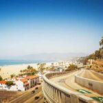
REVIEW · LOS ANGELES
Pacific Coast Highway: Smartphone Audio Tour, LA to Santa Maria
Book on Viator →Operated by Tripvia Tours · Bookable on Viator
A long stretch of PCH, turned into story time. This smartphone audio tour uses GPS timing so the commentary lines up with the ocean views, beaches, parks, and inland bluffs you’d otherwise rush past. I liked the way it adds small trivia questions and “wait, what’s that?” facts without bogging you down.
What I really enjoyed is how it makes a familiar road feel fresh: even if you’ve driven parts of the coast before, the details behind places like Marina del Rey, the Getty Villa, and Malibu’s rock beaches make you look twice. The only real drawback to consider is that the experience depends on the audio setup working smoothly; if your phone downloads or GPS playback doesn’t cooperate, it can fall flat.
In This Review
- Key points before you hit play
- Price and what $11.99 actually buys you on PCH
- The drive-friendly setup: what you need (and what you don’t)
- Pacing from Los Angeles: from Loyola history to a marina daydream
- Venice and Santa Monica: canals, beaches, and quick hits of coastal trivia
- The Getty Villa and Pacific Palisades: doing culture from the car
- Malibu in full beam: 21 miles of beach and the rock formations that stop you
- Tide pools and coastal diving: nature facts that make you look longer
- Santa Monica Mountain bluffs and Boney Mountain: when the road climbs into geology
- Oxnard and Ventura: strawberries, a deep-water port, and mission vibes
- Beaches in Solimar and Emma Wood, plus Rincon and Richfield
- Carpinteria bluffs, Channel Islands, and Santa Barbara’s scale
- UCSB coastline, tide pools, and Nojoqui Falls: nature with a side of science
- Lompoc-style murals and mission restoration, plus Vandenberg’s space mission
- Santa Maria Valley arrival: wine, trails, and the final stretch of viewpoints
- Who this tour is best for (and who should think twice)
- Should you book this Pacific Coast Highway audio tour?
- FAQ
- How long is the Pacific Coast Highway smartphone audio tour?
- What does the $11.99 price include?
- Do I need mobile data or a signal during the tour?
- Where does the tour start and end?
- Can I start anywhere along the route?
- Is this a private tour?
- What language is the audio in?
- Are attraction tickets included?
Key points before you hit play
- Offline by default: once the tour is downloaded, it uses no signal or data during the drive
- GPS-triggered audio: commentary tends to start when you’re near the next spot (handy in traffic and turns)
- Fun, low-effort pacing: you can do the suggested 4–5 hours or stretch it at your own speed
- Value for a vehicle group: $11.99 per group (up to 15) with only one booking per vehicle
- Lots of beach-and-views moments: from Venice and Santa Monica down through Malibu and the central coast
- Some content is more “school-like” than funny: if you want big jokes, it may not be your style
Price and what $11.99 actually buys you on PCH
At $11.99 per group (up to 15 people), this is priced like a smart road-trip splurge. The key detail is not the dollar amount—it’s the per-group structure. If you’re traveling with friends or family, one purchase covers the whole car, instead of turning it into a per-person fee that adds up.
You’re not paying for park tickets or guided entry. You’re paying for a self-guided audio route that helps you get more out of the drive from Los Angeles to Santa Maria. That matters on the Pacific Coast Highway because so much of the “experience” is what you notice while you’re driving—shoreline details, geology, cultural history, and the reason certain viewpoints are there.
You can also read our reviews of more tours and experiences in Los Angeles


The drive-friendly setup: what you need (and what you don’t)
This is a private experience for your group only—no mixing with strangers. You use your own smartphone (or tablet), in English, and the tour is designed to run while you drive your own vehicle.
One practical thing: you need good mobile/WiFi connection for the initial download. After that, the listing says no signal is required or data is used during the tour. For most people, that’s ideal, because the coast can be spotty for service. Still, I’d treat the “initial download” step like a must-do: do it on WiFi at home or at a hotel before you leave.
Also plan for this to feel like an “on-the-road playlist,” not a museum audio guide. The GPS timing helps your phone start the right track as you approach points of interest, which is great when you’re switching between beach pullouts and quick turns.
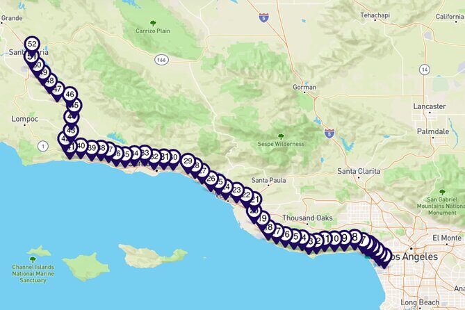
Pacing from Los Angeles: from Loyola history to a marina daydream
The tour starts in Los Angeles and ends in Santa Maria (on PCH 101 just south of the city). The route is built so you can begin at either end, but it’s flexible enough that you can start somewhere along the way if you’re staging your trip.
Early on, the audio gets you thinking about place right away. One stop is tied to a Roman Catholic tradition at a school formed from a merger of Loyola College and Marymount College. It’s the kind of detail you’d never notice from the highway—yet it sets the tone: the commentary keeps pointing out who built what, and why.
Then the narration shifts to water and boats with a stop at a marina developed in the 1950s that became North America’s largest man-made small-craft harbor. If you love maritime sights, this is the moment where you slow down just a bit more. Even if you don’t stop, the audio nudges your eyes toward the harbor and makes it feel like more than background scenery.
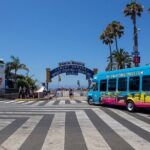
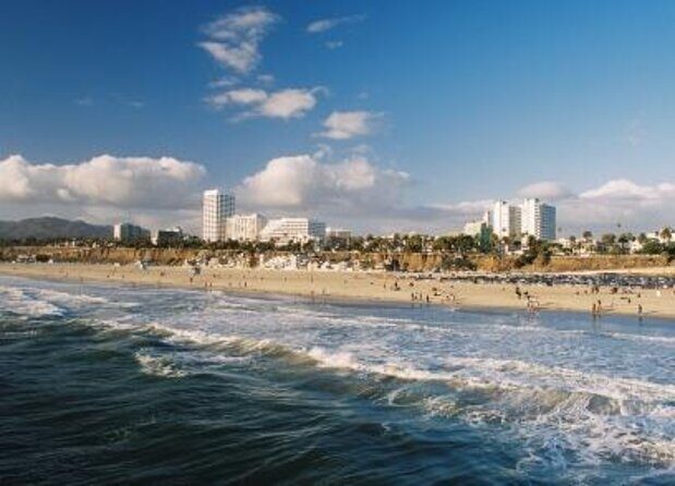
Venice and Santa Monica: canals, beaches, and quick hits of coastal trivia
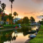
Next comes Venice—Venice Beach and the Venice Canals—which is one of those neighborhoods that always feels like it’s doing its own thing. The tour gives you just enough context so you notice patterns, not just crowds.
From there you glide past Will Rogers State Beach and Santa Monica Beach. The commentary style here is a good match for the real-world problem of PCH driving: you only get seconds at many pullouts, and you can’t read every sign. The audio keeps your attention moving, so you’re not relying on signage alone.
What I like is the way it blends geography with human stories. You’re not just hearing that beaches exist—you’re learning why they’re shaped the way they are, and what makes each stretch distinct.
The Getty Villa and Pacific Palisades: doing culture from the car
There’s a stop for the Getty Villa Museum, called out specifically for Italian villa style and its holdings connected to ancient Greek and Roman artifacts. Even if you don’t get out at the museum itself, the tour helps you understand why the area is so closely tied to art, money, and taste—because the Pacific Palisades neighborhood is part of that whole vibe.
This is a good segment for people who want the PCH to include more than sand and surf. If your idea of the coast trip is only beaches, you might feel a small culture dip here. But if you’re happy to mix it up, this is one of the stops that adds variety without forcing you into a long ticket line.
You can also read our reviews of more tours and experiences in Los Angeles


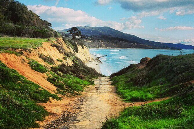
Malibu in full beam: 21 miles of beach and the rock formations that stop you
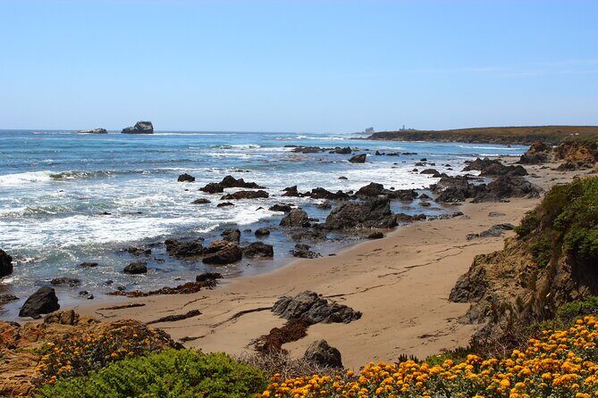
Malibu takes over the drive. The audio emphasizes that Malibu spans 21 miles of California beach, and it also talks about the area’s Mediterranean climate ecosystem. That environmental note is more useful than it sounds. It helps you understand why plants and landscapes change the way they do along this coast—so the scenery feels less random.
A stop at the Adamson-House is flagged as a must for history buffs. It’s the kind of place that gives you a human scale to the coast: before the highway, before today’s development, someone had a reason to settle, build, and preserve.
Then you hit the beach “greatest hits” part of Malibu:
- Zuma Beach, paired with the filming location Point Dume
- El Matador, known for massive, unique rock formations
- A reminder of the Chumash people, who lived here for nearly 8,000 years and had an extensive trading system across California
If you’re the kind of person who takes photos out the window, this segment is where you’ll actually want to pull over. The narration doesn’t just name beaches; it gives you a reason to care what you’re seeing.
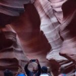
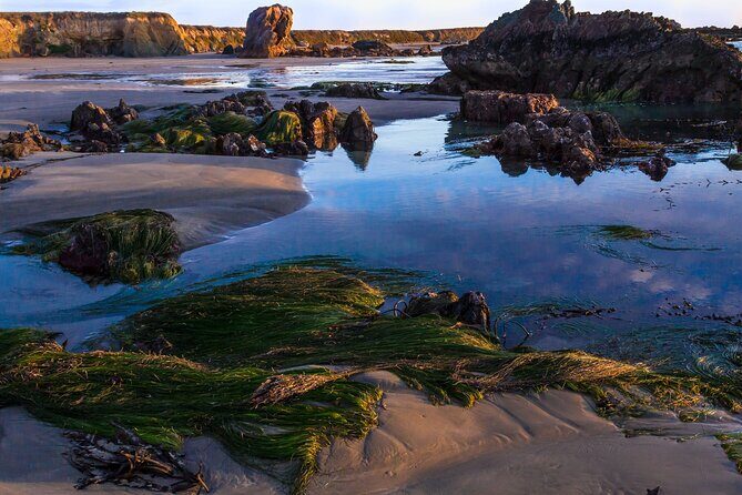
Tide pools and coastal diving: nature facts that make you look longer

One of the more memorable “science for the road” moments is the tour’s mention of a reef that’s used for coastal scuba diving. That’s not an instruction to suit up, but it reframes the shoreline: it’s not only pretty from above, it’s busy underwater.
The pacing also sets you up for later coastal stops where you’re told to notice what’s happening with tides and rocky pools. That’s where the audio can feel very “look at the tiny stuff.” If that’s your thing, you’ll love it. If you wanted more jokes than facts, this is where it might start to feel like homework.
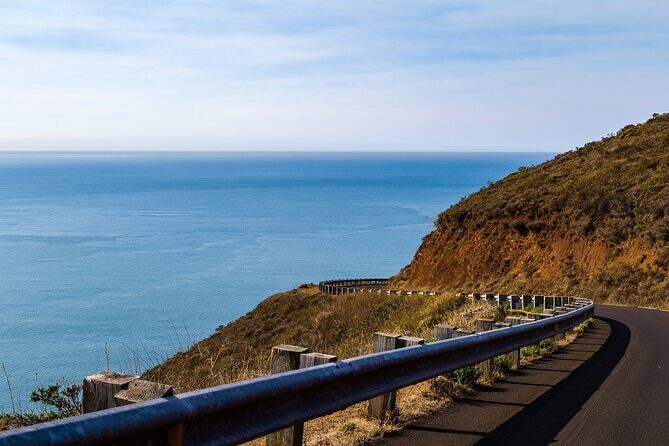
Santa Monica Mountain bluffs and Boney Mountain: when the road climbs into geology
After Malibu, the tour moves toward inland bluffs that are actually foothills of the Santa Monica Mountain range. This is where the commentary shifts from beach lounging to hiking-trail logic: canyons, views, and higher points like Boney Mountain.
A particularly unusual stop is about missiles you can see in the park, including the Polaris, described as the first U.S. submarine-launched ballistic missile. It’s one of those details that makes a coastal drive feel unexpectedly tied to national defense history. If you’re into strange, real-world facts you can tell later, this is prime material.
Oxnard and Ventura: strawberries, a deep-water port, and mission vibes
As you move toward the central coast, the audio keeps the road-trip rhythm going while adding more “California economy” context.
One stop explains that California supplies over 85 percent of US strawberries, with about a third coming from the Oxnard valley. That’s not just a trivia flex—it helps you picture what’s happening beyond the roadside billboards: farms, water, and a working landscape.
Another standout is a port described as the only deep-water port between Los Angeles and San Francisco. That’s a big claim, and it gives the coastal drive a bigger-map feeling, like you’re on a transportation spine, not just a scenic route.
There’s also a note about the Santa Clara as the largest natural river system in Southern California, draining several mountain watersheds and stretching 84 miles. It’s useful because it changes how you think about the coast: not just sand, but rivers, weather, and the way land and water carve the coastline over time.
Ventura’s downtown area gets the spotlight too, including a still-active Catholic parish, museum, and tourist-attraction. The tour keeps it practical—enough to set context without demanding you turn the drive into a full museum day.
Beaches in Solimar and Emma Wood, plus Rincon and Richfield
The route keeps threading in scenic coastal pockets, including Solimar and Emma Wood state beaches. If you’re the type to stretch stops into short walks, these are the kinds of places where you can do a quick “breathe, look, take photos” moment without a big time sink.
Then the tour mentions earthquakes and how a point was created, followed by the story of a small island connected by a very long pier: Rincon Island and Richfield Pier. Those details are the kind you can’t easily infer from the view alone, which is exactly why an audio tour works so well here.
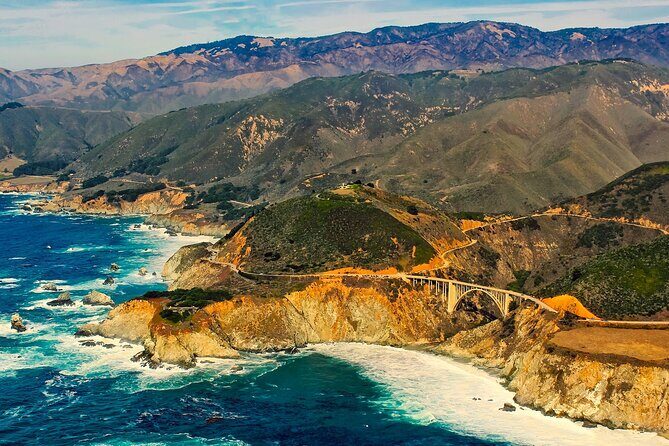
Carpinteria bluffs, Channel Islands, and Santa Barbara’s scale
Carpinteria’s bluffs are introduced with a civic detail: locals raised $6.9 million toward creating the Carpinteria Bluffs Nature Preserve. That single fact makes the area feel less like “pretty scenery” and more like an ongoing effort to protect it.
You’re also given a viewpoint stop at Vista Point, where you might see Santa Rosa Island if it’s clear. This is a reminder for how to time your photos: if you’ve got a hazy day, lower your expectations; if visibility is good, you’ll get extra payoff.
From there, the tour points to Channel Islands National Park with emphasis on marine and island wildlife and archaeological sites. Another segment mentions that Navy Seals are trained to withstand harsh conditions there. Even if that’s not your personal interest, it again shows how the environment is used in real life—not just admired.
Then it heads into Santa Barbara, tying local origins to the Chumash long before Europeans arrived. The scale is also stated plainly: Santa Barbara sees over 7 million tourists annually, so you can expect a popular town vibe. The shoreline highlights include nature preserves, a quiet beach, and a Monarch Butterfly Grove.
UCSB coastline, tide pools, and Nojoqui Falls: nature with a side of science
The tour runs alongside the Transverse Ranges and introduces UCSB as a top research university, noting award-winning faculty including six Nobel Prize winners. It’s a nice “big brain” pause in the middle of a beach-heavy drive.
There’s also a reminder about how protected coastal mountains help guard an endangered species, plus a tide-pool-like segment describing exposed tiny sea creatures—barnacles, starfish, sea anemone, crabs, and sea-sponges—as water pulls out. That’s the type of explanation that helps you stop pretending tide pools are just little puddles.
One segment calls out an environmental tragedy along a beautiful beach in 2015. Another notes the rugged coastline’s infamous reputation as a drop-off point for some nefarious activities—again, not to sensationalize, but to frame why certain stretches have strong stories attached.
Then you get Nojoqui Falls, described as unusual because they’ve built outward from a cliff over time. If you’ve only ever known waterfalls that erode upstream, this is a quick mental switch that makes the place feel more specific.
Lompoc-style murals and mission restoration, plus Vandenberg’s space mission
The tour includes a stop for a small city whose claim to fame is being home of split-pea soup. It’s the sort of oddball detail that keeps the coast from feeling like a single-note postcard.
It also points to La Purisima, with 2,000 acres restored to its peak period in the 1820s, when it was the seat of mission government. There’s mention of murals in alleyways and on building sides as a top attraction. Even if you just catch parts of it from the road, those facts help you understand what kind of town it is.
Then it moves to Vandenberg, described as part of the new branch of the US Armed Forces: Space Force. Hills are also mentioned as a hideout for bandit Salomon Pico, explaining why he was famous. This is another “wait, what?” section, where the coast becomes about more than shoreline.
Santa Maria Valley arrival: wine, trails, and the final stretch of viewpoints
The tour finishes in Santa Maria Valley, described as the second oldest American Viticultural Area, known for Pinot Noir and Chardonnay produced and bottled there. It’s a nice landing, because it gives your trip a clean theme for the last stretch: not just beaches, but agriculture and craft.
There’s also a Hurricane Deck Trail segment running along a ridge offering spectacular views. Nearby, the tour mentions settlers arriving in 1875 using free land, rich soil, and a cooler Mediterranean climate—useful context if you want to connect the valley’s beauty to what made it livable.
Other local stops are included in the mix, such as a winery and Conservatory Theatre in Santa Maria, plus rural park and trail references. Finally, the audio cycles through a long run of beaches and viewpoints—Oxnard shoreline, piers, parks by the shore, and ocean knolls—meant for you to stop when you feel like it.
Who this tour is best for (and who should think twice)
This works best for you if:
- You want a self-guided PCH route with structure, not a map-only drive
- You like hearing why things look the way they do—beach shapes, bluffs, tide pools, and local stories
- You enjoy trivia and short quizzes that make driving feel more like discovery
It might be a mismatch if:
- You want lots of humor. The content can skew more factual and geography-like.
- You rely on flawless phone behavior. If your downloads/GPS playback are flaky, you’ll feel it fast. One short tech failure can turn a good idea into a frustrating drive.
Should you book this Pacific Coast Highway audio tour?
I’d book it if you’re doing Los Angeles to Santa Maria and you want your drive to feel organized, informative, and just plain more fun. For the price, the big win is GPS-triggered narration plus trivia that makes even familiar scenery feel new. It’s especially worth it if you’re traveling as a group, because it’s per vehicle/group rather than per person.
I’d hesitate only if you know your phone setup is unreliable in cars, or you’re the type who expects comedy first and facts second. If you do book, treat it like a tech check before you leave—download on WiFi, charge your phone, and mount it where you can glance at it when the GPS cues come up.
FAQ
How long is the Pacific Coast Highway smartphone audio tour?
It’s designed for about 4 to 5 hours. You can take as long as you like.
What does the $11.99 price include?
It’s $11.99 per group (up to 15) for the audio experience. You use your own smartphone/tablet and your own vehicle.
Do I need mobile data or a signal during the tour?
No. The tour requires a good mobile or WiFi connection only for the initial download. During the tour, no signal is required and no data is used.
Where does the tour start and end?
It starts in Los Angeles, CA and ends in Santa Maria, CA, on Pacific Coast Highway #101 just south of the city.
Can I start anywhere along the route?
Yes. The tour starts or stops at either Los Angeles or Santa Maria, but you can start anywhere along the route.
Is this a private tour?
Yes. It’s private, meaning only your group will participate.
What language is the audio in?
The tour is offered in English.
Are attraction tickets included?
No. Attraction tickets are not included.